GDAL Layers
Uses the GDAL SDK to load imagery or elevation data. This is the most common layer type to use for local data files like GeoTIFF.
GDAL has dozens of loaders for different georeferenced file formats.
GDALImage, GDALElevation
Class: GDALImageLayer (inherits from ImageLayer)
Class: GDALElevationLayer (inherits from ElevationLayer)
| Property | Description | Type | Default |
|---|---|---|---|
| url | Location of data source (local or remote), e.g. a GeoTIFF file | URI | |
| connection | Connection string when querying a spatial database (like PostgreSQL for example) | string | |
| single_threaded | Force single-threaded access to the GDAL driver. Most GDAL drivers are thread-safe, but not all. If you are having issues with a GDAL driver crashing, try setting this to true. | bool | false |
| subdataset | Identifier of a sub-dataset within a larger GDAL dataset. Some drivers require this in order to access sub-layers within the database. | string | |
| vdatum | Specify a vertical datum to use (elevation only) | string | |
| Supported values = "egm96" or "egm2008" |
Earth file examples:
<GDALImage name="Local Data">
    <url>world.tif</url>
</GDALImage>

<GDALElevation name="Local terrian data">
    <url>elevation.dt0</url>
    <vdatum>egm96</vdatum>
</GDALElevation>
NOTE: this example loads a DTED0 elevation file, which is known to use the EGM96 vertical datum. We need to specify that in the earth file since the vertical datum information in NOT included in the source data itself.
GDALDEM
Displays a colorized or hill-shared representation of the elevation data in the map.
| Property | Description | Type | Default |
|---|---|---|---|
| processing | Type of shading to use. Options are color-relief and hillshade |
string | |
| layer | Elevation layer to use for shading | string | |
| color_filename | .clr file containing color-relief color map |
URI |
Examples
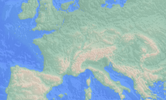
Start with a color relief display:
<GDALDEM name="Relief example">
    <processing>color-relief</processing>
    <layer>elevation</layer>
    <color_filename>../data/colorramps/thematic.clr</color_filename>
</GDALDEM>
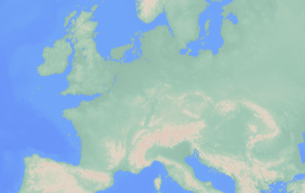
Blend in a hill-shaded display:
<GDALDEM name="Hillshade example">
    <processing>hillshade</processing>
    <layer>elevation</layer>
    <opacity>0.75</opacity>
</GDALDEM>